The following is an excerpt from an article published in the specialized Russian magazine URBAN, about a project I had the honor to lead, in collaboration with my colleague Sergei Mostovoi and students from the Far Eastern Federal University in Vladivostok, Russia.

The Russian government has been paying special attention to Vladivostok in recent years. The APEC summit held in September 2012 gave a fresh impetus to the development of the city as a centre of business and innovative cooperation between Russia and Asia-Pacific countries.
Preparations for such a significant international event called for serious efforts to create and improve Vladivostok’s infrastructure with upwards of 50 projects around the city having been completed or restored. Among them, the Far Eastern Federal University, a medical centre, three bridges, a theatre of opera and ballet, international airport and etc.
Notable changes have occurred in the infrastructure of Russky Island, where the summit was held. The mighty bridge across the Eastern Bosporus Strait incorporated the island into the transport network of Vladivostok and made it part of the city.
The rich natural landscape of the island makes it a good place to create a unique tourist and recreational zone, which would have a positive impact on the socio-economic life of Vladivostok.
Today the city’s development is gravitating towards the model of sustainable development combining an effective economy, harmonious social space and a comfortable urban environment.

For all their effort to improve the urban environment, however, the city government has been unable to resolve long-standing problems which go back to the past. In the 1960-ies the prominent architect E. Vasiliev who studied the urban problems of Vladivostok criticized the city’s greening policy (1).
According to Vladivostok’s Master Plan, the key objective is preservation and restoration of the city’s historical centre, which includes Main Square, the embankments of Amur and the Golden Horn Bays (2).
The historical centre, an iconic signature of Vladivostok, reflects the evolution of the Russian Far East and plays a key role in the city’s tourist infrastructure.
Given this, the policy-makers should take into consideration the problem related to construction of new high-rise tower blocks in the old centre as they clash with the city’s architectural heritage.
The creation of public open spaces will improve the architectural image of Vladivostok and its environment.

Vladivostok is rich in urban heritage, however the urban space is mostly occupied by parking lots that block the view of the monumental area.
However, there are some obstacles to be cleared. One of them is the lack of a comprehensive systematic approach to formulating and developing urban spaces in central Vladivostok. Solution to this problem is a top priority of the comprehensive plan for the development of Vladivostok’s waterfront, which is conducted by Prof. Carlos Zeballos (from Peru) and Prof. Sergei Mostovoi from the Urban and Landscape Design Laboratory of Far Eastern Federal University.
Despite the potential that waterfront areas offer, Vladivostok, unlike many other port cities, has very few public spaces, where people can enjoy contact with water. Paradoxically, most waterfront areas with a unique natural landscape are occupied by industrial estates, parking lots and disused beaches. Meanwhile, the existing public spaces, relatively small and scattered across the waterfront, have a weak connection with the city limiting the access of residents to the seaside.


Large waterfront areas with great potential for development are occupied by industry or neglected uses.

Proposal of a metro park, social housing and improvement of environmental conditions of industrial facilities.
According to recent world trends, waterfront areas possess specific social and ecological resources. Architectural and spatial rearrangement of these areas could help the city to achieve a goal of harmonizing the urban environment in the context of sustainable development.
The development of open spaces in Vladivostok should be based on the identification of urban interfaces – the areas of contact between ecosystems, through which multiple levels of interrelation as well as flows of materials, energy and information can converge. From the viewpoint of communication, interfaces can be positive when they allow and cause the transmission of information, or negative, when they do not. In addition, interfaces can be social or active when they have a unifying function, assuming the role of a node or institutional link, or they can be physical or passive when functioning at the edge or boundary between the active areas of the urban "tissue" they bind.

Analysis of interfaces. The darker red spots show the more feasible areas for intervention.
The interface method differs from traditional urban planning because it focuses on key, sensitive points where the city develops. Rather than investing a great amount of resources that standard urban plans generally involve, the efforts are focused on solving the interfaces, which are especially sensitive to the needs of people and their environment. Also, interfaces can serve a catalyst for urban change channeling positive and controlled impacts in their surrounding areas, which in turn affect others.
In order to identify the location of interfaces, several indicators or types of information related to the physical and socioeconomic characteristics of the area were used. Each indicator was mapped and values were assigned according to their positive or negative impact on the development of a public waterfront area. Prior to the analysis using Geographic Information Systems (specifically QGIS), these data were systematized, geo-referenced and rearranged in thematic layers according to the subject of research.
The layers were combined into a single map of interfaces. The darker areas correspond to the zones of major interfaces located on the waterfront and suitable for intervention.
Clearer tones correspond to either areas far from the waterfront or where intervention is neither feasible nor convenient.
The analysis of passive or physical interfaces identifies not only the location of the most sensitive areas, but also the characteristics of their environment. Additionally, active or social interfaces suggest the cultural features and the patterns of appropriation of public space. This study allows us to consider three main axes that structure the master plan for the development of the downtown and its waterfront.

The interfaces were arranged into three main axes: recreative, monumental and civic.
These three axes articulate a multipolar structure that establishes a street circuit encompassing ecological and recreational activities, transportation, tourism and preservation of the urban heritage.
However, it is arguable whether the mere presence of these axes would ensure a fluent dialogue between the city and the sea.
Jane Jacobs emphasizes the importance of access to urban spaces in order to prevent them from becoming abandoned areas that promote vandalism and crime(3).
Based on this analysis a spatial model of Vladivostok City was proposed, including the location of key projects and their interconnectivity through spatial axes or corridors. The plan proposes a continuity of urban renewal activities as well as links between the downtown, the Golden Horn Bay and the Amur Bay.

Master plan of Vladivostok, based on a network of public spaces, linked around three main axis
The master plan comprises the following projects:
Waterfront Metropolitan Park, located on the coast of the Amur Bay in the central part of city, is to become the biggest single multifunctional green space of around 20 hectares, home to both recreational and cultural activities. Currently it is a heavily polluted area with parking lots, industrial warehouses and garbage dumps. It would have a connection with Pokrovskiy Park via the extension of Krasnogo Znameni Prospect through a succession of embankments and boulevards. Realization of this project would contribute to the development of the green infrastructure in downtown Vladivostok.
Waterfront public green areas. Creation of a system of green areas would involve tackling three tasks: the improvement of existing parks and embankments along the coastlines of the Amur and Golden Horn Bays, the creation of new public spaces with beaches, fishing piers, bikeways and the articulation of these by means of corridors or pedestrian malls.
Integration of Power Plant #1, situated on the coast of the Amur Bay, into a large recreational complex would help to transform its territory into an attractive landmark in the urban landscape.
However, it is first necessary to reduce the power plan’s emissions and pollution level.
Pedestrian precincts. A network of paths injects the flow of the pedestrian traffic away from the city and along the coast. Construction of a new plaza under an existing railway would connect recreational zones on the coast of the Amur and Golden Horn Bays. Creation of pedestrian paths would provide a system of corridors with waterfront zones promoting a better visualization of the historic heritage buildings.
While working on this plan its authors took due account of the latest trends in contemporary urban design. According to European experts, future cities will be energy-efficient and green. New buildings will not burn fossil fuels and generate their own electricity.
The use of asphalt and concrete will be minimized. An abundance of urban greenery makes people feel more comfortable (4).


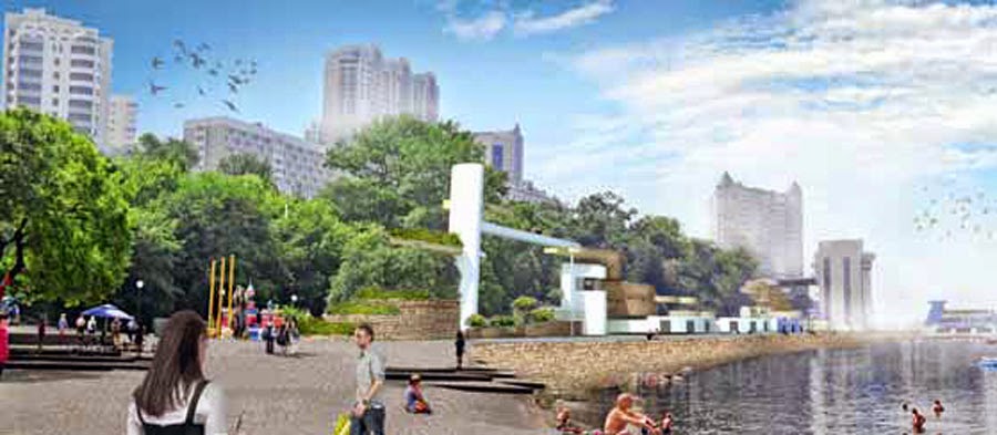
Two proposals for the pedestrianization and recovery of urban space for the people and its connection with the sea through new urban spaces.
Recently in Europe, non-car mobility has gained popularity and public transport is now accessible throughout the city. The new Vladivostok master plan should reflect such trends.
The development of public spaces and formation of a single recreational zone in Vladivostok tailored to the unique characteristics of the Amur and Golden Horn Bays represents a well-balanced dialogue between the city and the sea. The realization of this project will substantially improve the social and environmental situation in the Vladivostok.
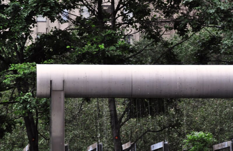
Recovery of the waterfront area and its link with the upper urban spaces through vertical accessibility
1 Vasiliev, E.A., Orlova, M.V., Sukhova, V.I. Problems of greenery in Vladivostok. Vladivostok, 1962. PP. 3-14.
2 The Master Plan of Vladivostok Metropolitan Area. Regulations on regional planning. 1028-PЗ1. Vol. 1. 2011. P. 13.
3 Jacobs, J. The Death and Life of Great American Cities / translated from English. Moscow. 2011. 460 p.
4 Cities of tomorrow – Challenges, visions, ways forward / European Commission – Directorate General for Regional Policy.
Luxembourg: Publications Office of the European Union, 2011. P. 43–46.


I would like to thank my dear students for their support and enthusiasm during the field work and proposals.